The world cannot function without reliable energy, and America's heartland still holds billions of recoverable barrels. LGX Energy brings modern 3D seismic technology to a proven, underexplored oil trend in southwestern Indiana, within the Illinois Basin.

For the better part of a century, wells in this region were located using sparse well logs, surface geology, and educated guesswork. Seismic imaging, standard practice in America's major basins, rarely reached the Illinois Basin's Indiana side. The result: a proven oil region left underexplored, and drilling capital exposed to avoidable dry-hole risk.

Modern seismic replaces the bet with a map. We use 2D seismic lines to map the oil trend and targeted 3D surveys to pinpoint drilling locations before the drill bit ever turns, lowering cost and risk on every well we plan.
3D seismic identifies undrilled locations in existing oil fields, replacing guesswork with high-resolution imaging.
Lower finding, drilling, operating, and land costs than most U.S. producing regions.
Shallow reserves in limestone, dolomite, and sandstone formations support accurate drilling and stable output.
A business-friendly environment where drilling permits can be secured in as few as 30 days.
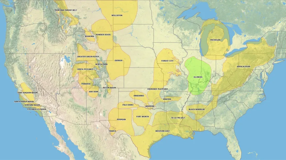
The Illinois Basin spans portions of Illinois, Indiana, and Kentucky; LGX's acreage and drilling program sit in the basin's Indiana portion. In 2007, the U.S. Geological Survey estimated the basin has produced 4.2 billion barrels of oil, with an estimated 4.1 billion barrels of recoverable oil remaining.
Most oil development on the Indiana side has never used seismic data. That is the opportunity.
Our model applies technological leverage to a proven, under-imaged basin. We hold and reprocess seismic data across a six-county position in southwestern Indiana, use 2D lines to map the oil trend and targeted 3D surveys to pinpoint drilling locations, then develop shallow, multi-pay prospects that carry lower drilling and operating costs than most U.S. plays. Each producing well is intended to fund and de-risk the next.
A large inventory of 2D and 3D seismic across the trend, continuously reprocessed as technology improves.
Prospects mapped, ranked, and confirmed with targeted 3D before any drilling decision.
Shallow, multi-pay wells with efficient timelines and local infrastructure.
Targeted leasing ahead of the drill bit, guided by the data.
A six-county data position. LGX holds over 400 miles of high-quality 2D seismic lines across six counties in southwestern Indiana, within the limits of the productive oil trend, with 80+ undrilled prospects identified to date.
Global supply disruptions have renewed attention on stable, domestic energy production. LGX is focused on regional supply from proven ground in America's heartland, a position we detailed in our June 2026 announcement with Regiment Securities.
Accredited investors can request the LGX Private Placement Memorandum and join our investor webinar series.